
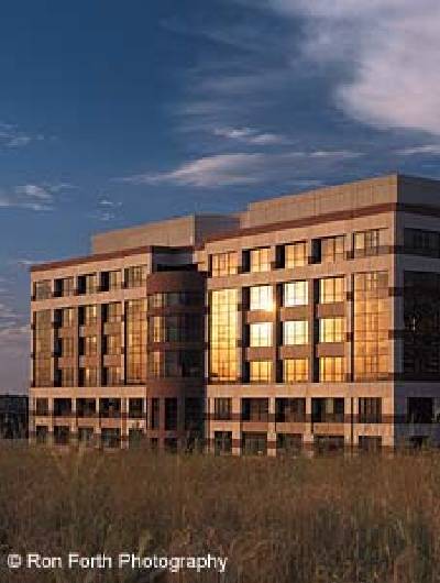
 These days, Jerusalem, a city located some 800 meters above sea level and home to 600,000 inhabitants, is being captured differently: its beauty and uniqueness are being snapped by citizens and tourists on film, in cameras and on videos.
And in the center of Israel’s capital, in the basement headquarters of the Jerusalem Center of Planning in Historic Cities, Kobi Ariel and his team are peacefully capturing – on computer – every street, every angle of Jerusalem. What’s more, this “conquest “will be for posterity.
Ariel’s only “weapon”: Bentley’s MicroStation, which he considers a decided winner.
“Our project is an ongoing lifetime job; it requires constant updating,” says Ariel. “But I am young,” he adds with a smile, implying that he expects to work many years on his exciting new project; the creation of a virtual model of Jerusalem. The project was started in late 1999 and is being developed using Microstation and other related software from Bentley Systems.
Bentley’s MicroStation is currently being used successfully in creating city models in 6 cities in the United States: Washington, D.C., New York, Philadelphia, Boston, Orlando, Florida and Charlotte, North Carolina . In other countries, it is in use in Sydney, Australia and Tokyo, Japan. Plans are afoot to create virtual city models in cities across the United States as well as in a few in Central America.
Before MicroStation became available, Ariel, an industrial designer, worked, together with his team, on a physical model of the city. It is a wood and plaster miniature made to a scale of 1:500. “What took 20 years to build the physical model will take less than a year on the computer,” he says.
Asked what made Microstation software unique Ariel replied, “Other software can document houses, at the most neighborhoods. MicroStation is designed for large-scale engineering across the Internet and incorporates 3D modeling and photorealistic visualization and animation. MicroStation, is, in effect, the only software that has the ability to deal with all aspects of a city model. On the one hand, it has the ability to work on the smallest architectural details, on the other hand it possesses the ability to work on huge areas – compounds, neighborhoods, entire cities.”
The fundamental steps involved in creating virtual Jerusalem are as follows…
1. “The first step is obtaining maps from the municipality’s GIS department,” says Michal Ben-Hamo, Ariel’s young assistant. A mother with a 4 year old son and 3 month-old daughter, Michal took a special course to acquaint herself with the software. “These GIS maps provide topographic data including the various heights (Jerusalem is a hilly town), street names, names and outlines of buildings, even trees. We activate only those layers of the city hall maps that are relevant to identify the information we need and determine points of elevation and create a 3D topographic map.” The information is created in AutoCAD with ArcInfo and MapInfo and provided in DXF format.
2. As a second step–employing MicroStation/J–the building outlines are brought to the height of the roofs and closed, to create polygons. The “z” data is mad available in the municipal GIS information.
3. The polygon boxes are then extruded, adding volume and making them three-dimensional. They are added to the topographical model. From this point on, recreating the virtual city becomes a solids modeling exercise. Here Ariel’s team used the MicroStation TriForma software, a platform for 3D building and plant applications, including modeling and documentation. “The easy-to-use modeling tools allow us to quickly sculpt, modify and visualize our city model,” says Ben-Hamo.
4. Now come roads, streets and traffic islands. For a while they hover in the air until they are brought down in place to their correct height on the topographical model. This step also involves carving and pasting such details as niches, tiled roofs, external stepped balconies, fences, etc. For this are used both MicroStation/J and Modeler.
5. Then follows the apportionment of textures – there are literally hundreds to choose from. Textures such as brick, stone, stucco or rough plaster are assigned to exterior and interior walls. Michal allots different colors to the different elements that make up the picture on the screen.
6. Finally, specific buildings are “taken apart” Details such as facades, doors, windows, etc. complete the design. Required for this process are digital photos – taken both from the air and in situ – which are then pasted as a raster screen onto the computerized buildings.
So far, Ariel’s computer team has concluded work on 20 maps of the center of town – an area of 2×2.5km.
Prominent edifices such as historical structures, public buildings, churches and synagogues and high rises get special treatment. While ordinary buildings remain as cubes, others, somewhat more important, get 2D facades, while the above-mentioned prominent structures receive a 3D facade plus texture and colors.
The Jerusalem YMCA is such a special building. It actually has something in common with the Empire State Building in New York: each was the tallest structure in its city at the time it was built, and both were designed by the same architect, Arthur Louis Harmon.
The building is a combination of Byzantine, Romanesque, Gothic and neo-Moorish architecture. It is, above all, a symbolic building, meant to be reminiscent of early architectural traditions of Judaism, Christianity and Islam. Thus, the foundation contains stones from quarries believed to have been used in the construction of the Second Temple; the Christian aspect is evident in the Romanesque and Gothic styles, exemplified, inter alia, by the vaulted ceilings; while a large dome and painted arabesques at the entrance hall are typical Islamic elements. On the lobby floor is an excellent mosaic replica of the famed Madaba map (The original mosaic is in Jordan).
 virtual model") Continuing the symbolism, 40 columns in the forecourt arcade represent 40 years of the Jews’ wandering in the desert and the 40 days of the temptation of Jesus. Twelve huge windows in the auditorium and twelve cypress trees in the garden are meant to signify the twelve tribes, the twelve disciples of Jesus and the twelve followers of Mohammed.
Continuing the symbolism, 40 columns in the forecourt arcade represent 40 years of the Jews’ wandering in the desert and the 40 days of the temptation of Jesus. Twelve huge windows in the auditorium and twelve cypress trees in the garden are meant to signify the twelve tribes, the twelve disciples of Jesus and the twelve followers of Mohammed.
From the top of the 5-meter tower one has a panoramic view of Jerusalem and surroundings. High on the tower is a relief figure of the six-winged seraph of Isaiah’s vision (Isaiah 6:2-3). The capitals of two columns at the entrance, of polished red stone, depict a lamb representing the sacrifice of Jesus and the Woman of Samaria with a jug on her head, mentioned in the New Testament.
On special occasions, the YMCA’s 35 carillon bells – the largest of which weighs one and a half tons – are activated. The carillon chamber also contains carvings of the four instruments mentioned in the Bible: lyre, horus, horn and harp.
“When we connect our model to a database, partly GIS, partly our own,” states Ariel, “it will permit the retrieval of cross sections of different periods, styles, individual architects, as well as heights of buildings and the uses of these buildings. It will also offer visual cross sections of skylines, perspectives from a pedestrian eye level, and changes of sun and shade at different seasons and different hours.
Aerial view of the entire (so far) virtual model Aerial view of the entire (so far) virtual model
So much for documenting existing city features. “Our model is used for architectural visualisation and evaluation for both existing and future construction,” explains Kobi Ariel. “When a new building is proposed, we take the architect’s – usually – 2D drawings – plans, sections, elevations, details, specifications – and transform them into 3D models.
Ariel has far-reaching plans: he wants, to eventually have the model and its information available on the Internet “for professional use of architects wherever they may be, for better planning.”


I am interested in creating a 3D tourist map of Jerusalem. Is the dxf file available?