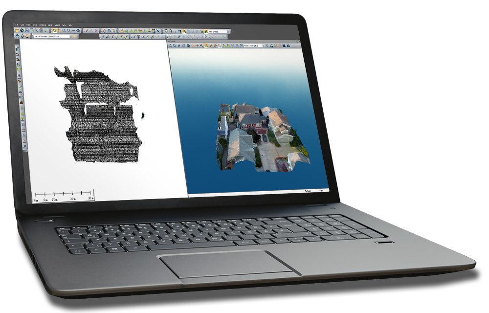
Blue Marble Geographics of Hallowell, ME has announced the release of the latest version of Global Mapper with its accompanying LiDAR module.
Blue Marble says the new release provides an extensive collection of new tools, enhanced functionality, performance improvements, and newly supported file formats.
Global Mapper v20.1
- Revamped Path Profile tool with zooming capability
- Legend display in the profile window indicating which overlapping terrain layers are displayed
- A new Digitizer tool for automatically removing gaps or overlap in adjacent polygons
- Configuration option to set a default projection which is automatically applied when importing or creating a layer
- Support for downloading vector features from Esri RESTful data sources
- Dramatically faster viewshed calculations on computers with multiple cores
- Significant speed improvements loading and working with workspaces, GMP files, and any vector data with attributes
- Support for several new file formats including OpenFlight and HEC-RAS raster and vector formats
LiDAR Module v20.1
- Proximity query function to identify points of a certain class encroaching on other points or line features
- Tool for selecting LiDAR points above or below a line drawn in the Path Profile view
- Several new point cloud thinning options, including thinning of selected points, thinning by retaining every Nth point, and whether to mark thinned points as deleted or move them to a new layer
- EDIT_LIDAR and DEFINE_LIDAR_FILTER script commands to allow editing of points based on their proximity to other LiDAR points and line features
- New option to quickly select points by classification in selected LiDAR layers
Global Mapper is an affordable and easy-to-use GIS application that offers access to 300+ spatial datasets. It provides functionality in terrain analysis and 3D data mapping to satisfy experienced GIS professionals and beginner users. The optional LiDAR module provides advanced LiDAR processing tools, including a photogrammetric point cloud creator, 3D model or mesh creation from a point cloud, automatic point cloud classification, automatic extraction of buildings, trees, and powerlines, cross-sectional viewing and point editing, custom digitizing or extraction of 3D line and area features, dramatically faster surface generation, LiDAR quality control, and more.
Learn more from Blue Marble Geograhics

